Blue Sky Awaits
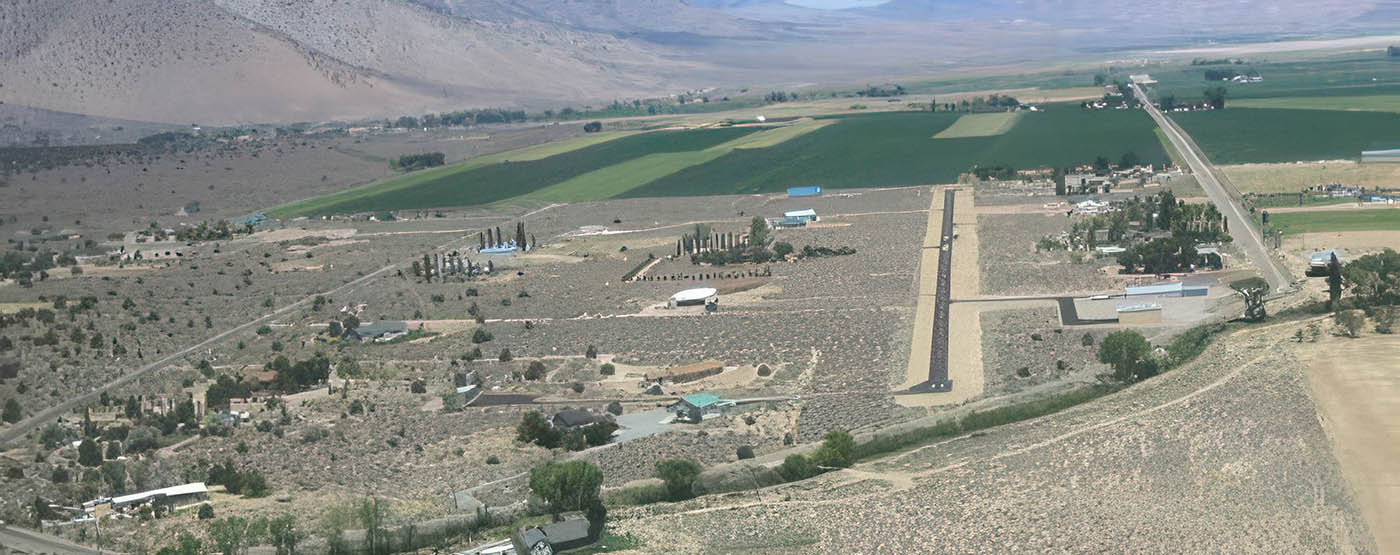
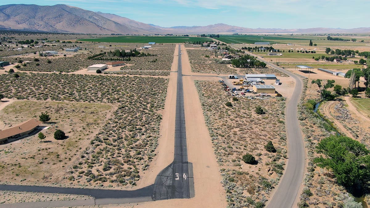
Welcome to NV33 Farias Wheel Airport, Wellington Nevada
Table of Contents
FAA Identifier: NV33
Location
| Lat/Long: | 38-49-59.6800N / 119-23-45.5810W 38-49.994667N / 119-23.759683W 38.8332444 / -119.3959947 (estimated) |
| Elevation: | 4848 ft. / 1477.7 m (surveyed) |
| Variation: | 16E (1985) |
| From city: | 6 miles West of SMITH, NV |
| Time zone: | UTC -8 (UTC -7 during Daylight Saving Time) |
| Zip code: | 89444 |
Airport Use: Private use. Permission required prior to landing
Airport Operations
| Activation date: | 10/1965 |
| Sectional chart: | SAN FRANCISCO |
| Control tower: | no |
| ARTCC: | OAKLAND CENTER |
| FSS: | RENO FLIGHT SERVICE STATION |
| Attendance: | UNATNDD |
| Wind indicator: | lighted |
| Segmented circle: | no |
| Lights: | ACTVT MIRL RY 16/34 AND ARPT BCN 122.9. |
| Beacon: | white-green (lighted land airport) |
Airport Communications:
WX AWOS-3PT at MEV (19 nm NW): 119.325
(775-782-6264)
Airport Services
| Fuel available: | 100LL EMERGENCY FUEL ONLY. |
| Parking: | tiedowns |
| Airframe service: | NONE |
| Powerplant service: | NONE |
| Bottled oxygen: | NONE |
| Bulk oxygen: | NONE |
Airport Operational Statistics
| Aircraft based on the field: | 22 |
| Single engine airplanes: | 20 |
| Multi engine airplanes: | 2 |
| Aircraft operations: avg 29/week * | |
| 78% | local general aviation |
| 20% | transient general aviation |
| 2% | air taxi |
| * for 12-month period ending 05 July 2006 | |
Airport Use: Private use. Permission required prior to landing
Runway Information
Runway 16/34
| Dimensions: | 3391 x 22 ft. / 1034 x 7 m 22 FT WIDE ASPHALT CENTER ON 100 FT WIDE DIRT RY. | ||
| Surface: | asphalt, in good condition | ||
| Runway edge lights: | non-standard NSTD MIRL DO NOT RUN FULL LENGTH OF RY EITHER SIDE. RY 16 MIRL ON LEFT SIDE ONLY EXTEND FIRST 2/3 OF RY. RY 34 MIRL ON LEFT SIDE ONLY EXTEND FIRST 2/3 OF RY. | ||
| RUNWAY 16 | RUNWAY 34 | ||
| Traffic pattern: | left | right | |
| Markings: | none | none | |
| Obstructions: | 30 ft. tree, 350 ft. from runway ROAD CROSSES DIAGONALLY 120 FT FM RY 16 THLD. | 40 ft. tree, 200 ft. from runway ROAD CROSSES DIAGONALLY 100 FT FM RY 34 THLD. | |
Airport Ownership and Management
Additional Contacts:
| Ownership: | Privately-owned | |
| Owner: | VALLEY VIEW AIRPORT, LLC PO BOX 347 WELLINGTON, NV 89444-0347 NV33Airport@gmail.com | |
| Manager: | PETER HANSEN 565 Upper Colony Road WELLINGTON, NV 89444 Phone 360-852-3400 NV33Airport@gmail.com | JEANNE PIERCE Phone: 775-790-2144 WILLIAM OXX Phone: 775-901-1356 |
Instrument Proceedures
There are no published instrument procedures at NV33.
Some nearby airports with instrument procedures:KMEV – Minden-Tahoe Airport (19 nm NW)
KCXP – Carson Airport (27 nm NW)
KTVL – Lake Tahoe Airport (28 nm W)
KRNO – Reno/Tahoe International Airport (44 nm NW)
KTRK – Truckee-Tahoe Airport (45 nm NW)
22
Aircraft
20
single engine
2
Multi Engine